Historic Maps of Parkersburg
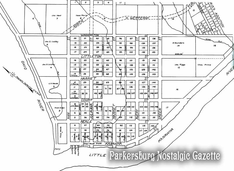
Town of Parkersburgh, [West] Virginia - 1817
1912 enlarged transcript (of original 1817 plat) by E. N. Woodyard, Surveyor of Wood County
Source: Wood County Deed Book #5, Page 337 (on file in Wood County Courthouse)
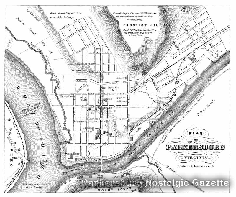
 Plan of Parkersburg [West] Virginia - 1860
Source:
Notices of Virginia as of July, 1860
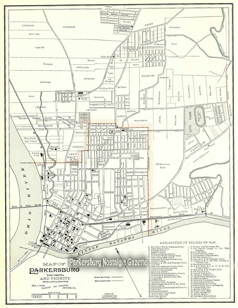
 Map of Parkersburg West Virginia and Vicinity - 1898
Source:
Cram's Universal Atlas, Geographical, Astronomical and Historical (Chicago: George F. Cram, 1898)
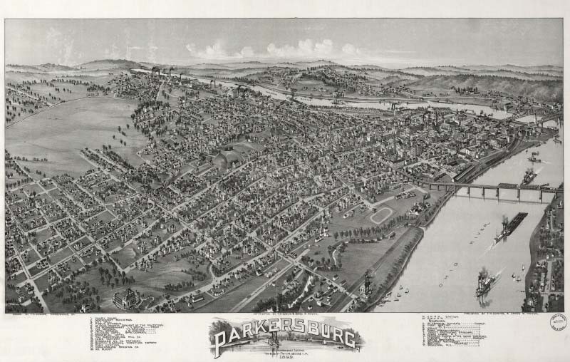
 Parkersburg, West Virginia 1899
Bird's-eye-view map drawn by Thaddeus Mortimer Fowler
Source: Library of Congress, Geography and Map Division